IEEE Winter Conference on Applications of Computer Vision (WACV 2026) — Tucson, AZ
AirLock+: Scaling UAV-to-Satellite Image Registration for
Target Geolocalization and Geospatial Augmented Reality
Overview
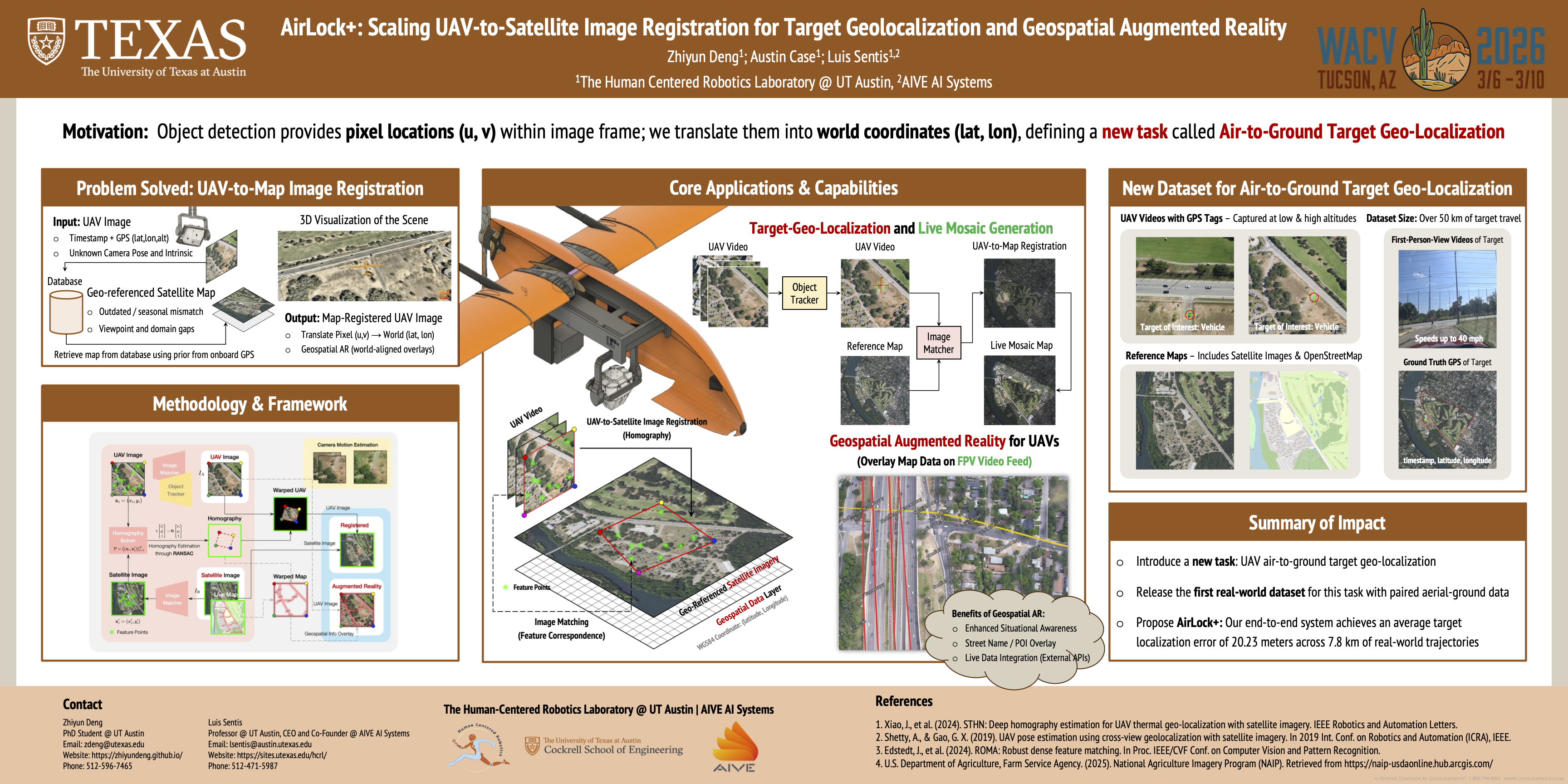
AirLock+ locates UAV-observed targets in world coordinates and overlays map-aligned graphics on live drone feeds.
assets/poster.png
Dataset
We release the first air-to-ground target geolocalization dataset, with paired UAV and vehicle's FPV video and geo-referenced satellite maps to support UAV-to-Map registration.
Dataset Download
All 7 flight sequences captured in Austin, TX with a DJI Air 2S, hosted on Hugging Face.
Reference Maps
Geo-referenced GeoTIFF tiles at zoom 17 — satellite imagery, OpenStreetMap, satellite+streets, and streets-only layers covering all flight areas.
UAV Aerial Video
7 sequences of aerial footage from a DJI Air 2S at altitudes ranging 118–452 m AGL, with embedded SRT telemetry and extracted GPS CSV. Available as camera-native 2.7K masters and 1080p proxies, each with matching OpenCV camera calibration.
Vehicle FPV Video
First-person view footage from a GoPro mounted on the target vehicle, covering 5 of the 7 flight sequences. Includes raw MP4 and GPS logs from the Phyphox app.
Time-Synchronized GPS
Per-frame CSV files aligning drone telemetry to the UAV video timeline, with vehicle GPS linearly interpolated onto the same axis. Includes a manifest and generation script.
Position-Map Videos
UAV-centered map videos rendered over the satellite+streets basemap, showing a 350 × 350 m window that follows the UAV. Cyan marks the UAV, red marks the vehicle, and each clip matches the duration of its source UAV video to within one frame.
Or pull the whole dataset from the command line:
hf download zhiyundeng/AirLock-WACV2026 --repo-type dataset --local-dir AirLock
Please don’t hesitate to reach out to Zhiyun Deng at zdeng@utexas.edu if you have any questions about the dataset.
BibTeX
@inproceedings{deng2026airlock+,
  title={AirLock+: Scaling UAV-to-Satellite Image Registration for Target Geolocalization and Geospatial Augmented Reality},
  author={Deng, Zhiyun and Case, Austin and Sentis, Luis},
  booktitle={Proceedings of the IEEE/CVF Winter Conference on Applications of Computer Vision},
  pages={3340--3349},
  year={2026}
}